The Cabinet Mountains
The Cabinet Mountains are a mountain range in western Montana and northern Idaho. Spanning eastward from Idaho’s Panhandle to the Mission Mountains of western Montana, much of the range is encompassed by the Kootenai and Lolo National Forests, with the far eastern portion falling within the boundaries of the Flathead Indian Reservation.
The Cabinet Mountains still harbor islands of wild country that rival any in Montana, but these pockets of wilderness are rapidly disappearing. Past, present, and future prospects of industrialization threaten what remains of the mountain ranges roadless lands. Foot trails to the remote reaches of the backcountry are now frequently being used by motorized recreationists, displacing wildlife, and shattering the solitude.
All is not lost, however, and there is unspoiled wilderness remaining, but now is the time to extend protections to the remaining wildlands. The Northern Rockies Ecosystem Protection Act (NREPA) would provide the highest level of protection for roadless areas. https://allianceforthewildrockies.org/nrepa/
For more information on roadless areas in the region visit:
THE KOOTENAI NATIONAL FOREST AND WILDERNESS
A significant portion of the Cabinet Mountain range lies within the jurisdiction of the Kootenai National Forest. The percentage of lands that is unroaded in the Kootenai National Forest is approximately 34%. By comparison, 80% of the lands in the Bitterroot National Forest are roadless, and in the Gallatin National Forest that amount is 86%. The Kootenai also has the smallest percentage of wilderness of any national forest in Montana with only 4% of the 2.2 million acres currently protected. By comparison, the Bitterroot National Forest is approximately 47% wilderness. There are 43 Inventoried Roadless Areas (IRAs) in the Kootenai, totaling almost 640,000 acres. Noteworthy are the East Face and West Face, and Galena IRAs. These wildlands are adjacent to the Cabinet Mountains Wilderness and would be critical additions to a wilderness that has been besieged by multiple mining proposals throughout its 45-year history.
THE CABINET MOUNTAINS WILDERNESS
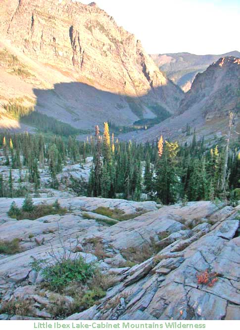
he Cabinet Mountains Wilderness is located in the Kootenai National Forest, approximately 15 miles southwest of Libby, Montana in the northwestern corner of the state. This area contains some of the most beautiful sub-alpine scenery in western Montana. Elevations range from 3,000 feet to 8,738 feet atop Snowshoe Peak. Variety best describes the Cabinet Mountains Wilderness with its high, rocky peaks often snowcapped year-round crowning canopied valleys that harbor groves of huge cedars thriving in a temperate rainforest climate. Hidden in the peaks and ridges are scores of deep blue lakes, feeding clear, cold streams that tumble to moose country below.
When the Wilderness Act of 1964 was passed, the Cabinet Mountains Wilderness was one of the nation’s first ten wilderness areas to receive protection. Today, the Cabinet Mountains Wilderness remains the sole wilderness area in the Cabinet Mountains Range and in the 2.2 million-acre Kootenai National Forest. Unfortunately, this wilderness has been continuously plagued by the threat of hardrock mining. Two massive mining projects have been proposed that would operate beneath and adjacent to this wilderness. The Rock Creek and Montanore mines would include numerous surface intrusions and impacts, with support facilities rimming the border. Expanding the Cabinet Mountains Wilderness is absolutely essential. This wilderness is only 94,360 acres and needs to be enlarged to offset the ongoing mineral threats near its borders. Annexation of the East Face, West Face, and Galena Inventoried Roadless Areas also would add habitat for the dwindling populations of grizzly bear, lynx, wolverine, mountain goat, and other species that are threatened by industrialization and motorized recreation.
THE LOLO NATIONAL FOREST AND WILDERNESS
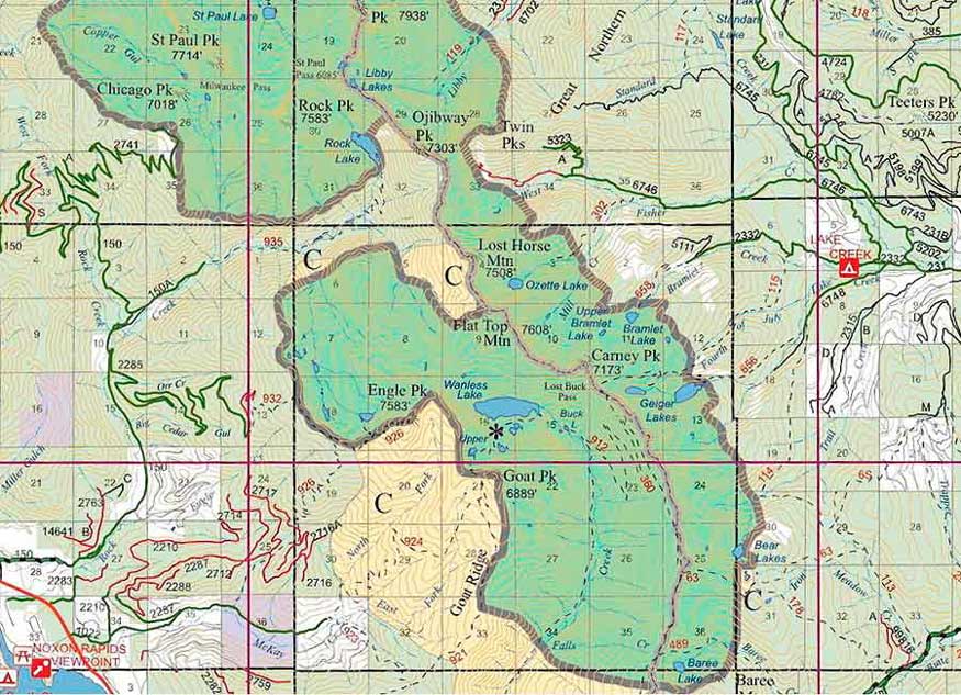
The middle portion of the Cabinet Mountains is located within the Lolo National Forest. The 2.0 million-acre Lolo National Forest fairs only slightly better with wilderness designation than the neighboring Kootenai National Forest, with 7% of the forest protected. There are approximately 37 IRAs in the Lolo totaling nearly 750,000 acres. The crown jewel of the Cabinet portion of the forest is the Cube Iron/Mt. Silcox Inventoried Roadless Area near Thompson Falls, Montana. Comprised of mountain peaks and alpine lakes, this IRA was included in the 1988 Montana wilderness legislation that was vetoed by Ronald Reagan. In 2021, a good portion of this IRA burned. Within the Bitterroot Mountains portion of the Lolo National Forest, the Great Burn IRA near Superior, Montana has long deserved protection, but has yet to be included in any proposed legislation.